Weather
World news
ACCUWEATHER, ASIA, BERNIE RAYNO, COLOMBIA, CUBA, EVACUATIONS, FLORIDA, GULF OF MEXICO, HURRICANE, HURRICANE CENTER, HURRICANE SEASON, MEXICO, NATIONAL HURRICANE CENTER, NATURAL DISASTER, NHC, NORTH AMERICA, PHILIPPINES, PROGRESO, PUERTO RICO, SOUTH AMERICA, WEATHER, WIND GUSTS
Maya Ramirez
0 Comments
Hurricane Rafael Strengthens to Category 3, Tracking Away from Florida
Hurricane Rafael has strengthened to a Category 3 storm with winds of 120 mph but is moving westward away from Florida. The storm is expected to weaken but will create dangerous swells along the Gulf Coast. A low-pressure system near Puerto Rico is bringing rain but poses low development chances. Residents are advised to stay alert as hurricane season continues.
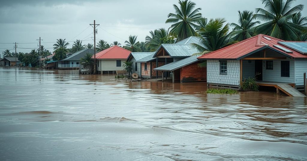
The National Hurricane Center has reported that Hurricane Rafael has intensified into a Category 3 storm with sustained winds of 120 miles per hour. Fortunately, its current trajectory indicates it is moving west through the Gulf of Mexico, away from Florida, where it is anticipated to weaken in the coming days. Additionally, there is a trough of low pressure near Puerto Rico causing rainfall and thunderstorms, although the likelihood of further development remains low. Rafael has significantly impacted western Cuba, disrupting the entire electrical grid before reintensifying as it moved. The storm is currently being pushed westward due to a mid-level ridge, distancing it from the Sunshine State, and preventing it from moving northward towards potential landfall along the Gulf Coast. AccuWeather expert Bernie Rayno predicted that as Rafael continues on its west-southwest path, it will encounter increasing wind shear, which typically leads to a gradual loss of intensity. Moreover, while Rafael itself is expected to remain offshore, its generated swells threaten to produce dangerous surf and rip current conditions along the Gulf Coast over the next few days. Residents in the southern and southwestern Gulf of Mexico are advised to keep track of the storm’s developments. The hurricane’s coordinates have been recorded at 24.5N 88.0W, approximately 245 miles from Progreso, Mexico, with maximum sustained winds at 120 mph and a current movement west at 9 mph. The National Hurricane Center is simultaneously monitoring other systems, including a low-pressure trough located north of Puerto Rico, which shows minimal potential for development but could lead to heavy rains across multiple islands. Notably, the Atlantic hurricane season, which commenced on June 1, will conclude on November 30, and residents are encouraged to remain vigilant during this period.
Hurricane Rafael’s development into a Category 3 storm highlights the ongoing concerns associated with tropical cyclones in the Atlantic basin. This storm’s path is particularly relevant, given its potential impacts on coastal regions, including Florida. As the season progresses, the National Hurricane Center plays a crucial role in tracking these storms and providing timely updates to ensure public safety. The trough of low pressure near Puerto Rico serves as an example of how multiple systems can affect weather patterns and rainfall in the Caribbean.
In conclusion, Hurricane Rafael has escalated into a significant storm, with the National Hurricane Center predicting its movement further away from Florida. Despite its current intensity, the storm is expected to weaken as it moves westward through the Gulf of Mexico. The potential for hazardous surf conditions remains a concern for the Gulf Coast, warranting continued vigilance among residents. Additionally, the associated trough near Puerto Rico illustrates the complexities of hurricane season, emphasizing the importance of staying informed.
Original Source: www.news-press.com


Post Comment